A listing usually starts with the house: the façade, the living room, the kitchen. But buyers on the Costa del Sol are often buying something that no interior photograph can show: a plot, a view, a position between the mountains and the sea. That is the job of an aerial image.
Aerial photography is easy to admire and easy to misuse. This article looks at it from the point of view of image and communication: what it adds to a listing, which properties benefit, how a good aerial photograph is composed, how light changes it and how to place it in your marketing so that it supports the story instead of decorating it.
What an aerial view shows that a ground-level photograph cannot
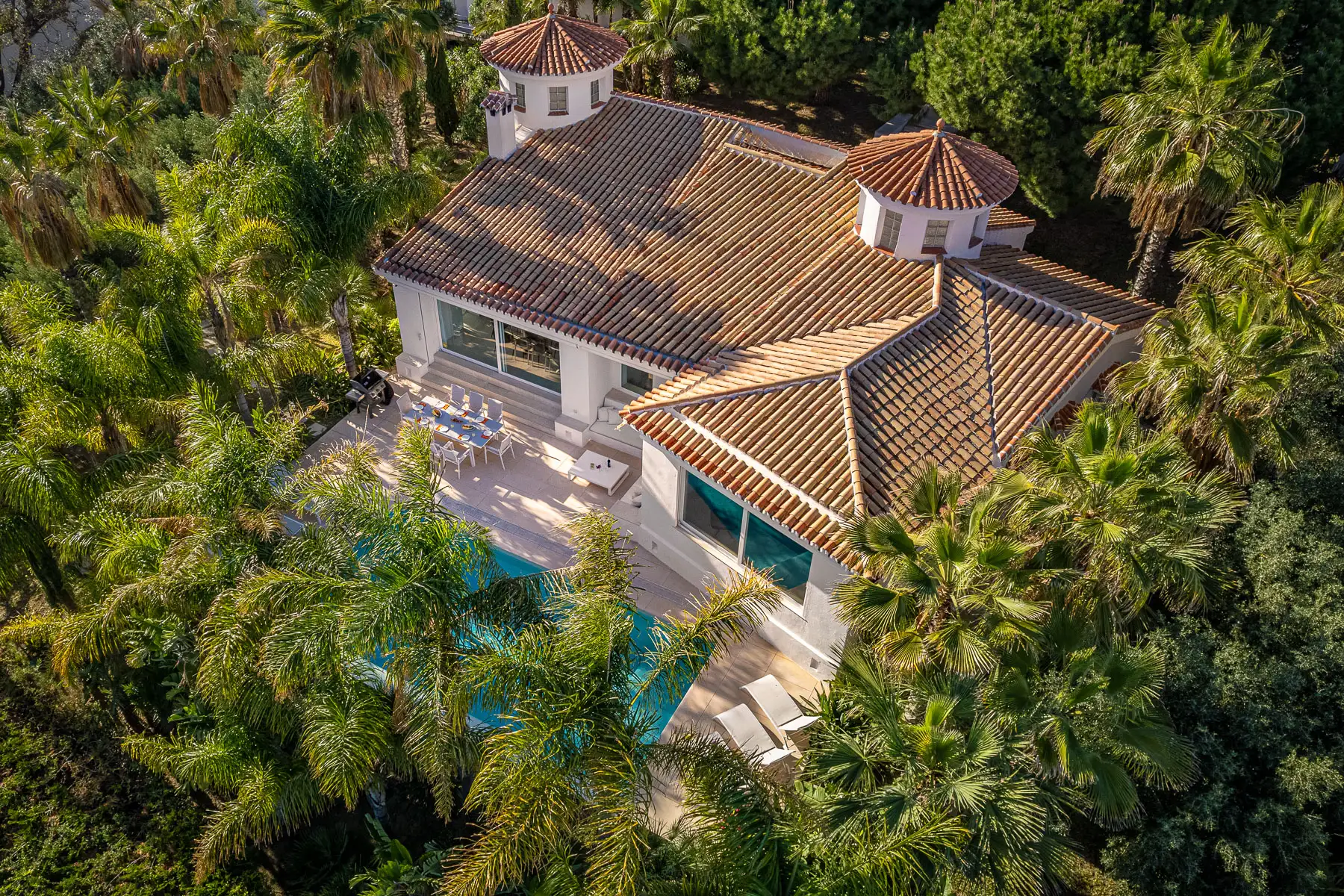
A ground-level photograph tells you what a space is like. An aerial one tells you where the property is and how it sits in its surroundings. In a single frame it shows the size of the plot, the position of the house and the pool, the garden, the boundaries, the neighbouring buildings, the road and the landscape around them. Several of those things are hard to explain with words and almost impossible to show with interior photographs.
It also introduces scale. A buyer who sees a villa from the front can estimate its size, but seen from above, with its terraces, annexes and garden, the property reveals proportions that the interior photographs cannot. And it adds orientation: where the sun falls, which side faces the view and where the sea is in relation to the house.
Strategically, an aerial image answers an early question: is this the kind of place I am looking for? If the answer is yes, the buyer goes on to the interior. If it is no, the listing has saved everyone a visit. Either way, the image has done useful work.
Which properties gain most, and which gain little
Aerial images are most valuable when the appeal of the property lies partly outside its walls. In our experience that includes:
- Villas on large plots, where the garden, the pool and the privacy are part of the product.
- Panoramic views, especially sea or mountain views that are hard to appreciate from the ground.
- Properties with several structures, such as a main house with a guest house or annexes.
- Sloping or uneven terrain, where the way the property sits on the land explains its value.
- Developments and urbanisations, where the position of each home within the whole matters.
- Scenic surroundings and key locations, near the sea, a golf course or a landmark.
The same property can call for different images depending on who will see them. An international buyer wants to understand the location. A family wants to see the garden and the pool. An investor looks at the plot and its surroundings. Think about the audience first, and the choice of shots becomes much easier.
It is only fair to say when they add little. A flat in the middle of a block with no distinctive outdoor setting gains less from the air. An image of the building and its surroundings can still help, but the interior photographs, the floor plan and a virtual tour will carry more weight. Choosing where to use aerial images, and where not to, is part of a good communication strategy.
How a good aerial image is composed
A drone gives access to any viewpoint, which is exactly why the choice of viewpoint matters. Four decisions shape an aerial photograph.
Angle: oblique or top-down
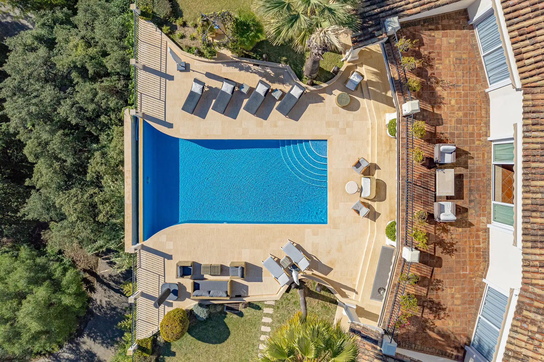
An oblique view, looking down at an angle toward the house, feels like a real view. It has depth, shows the façade and the surroundings and is the most natural way to present a property. A top-down view is more graphic. It turns a pool, a garden or a roof into a pattern and works well to show the layout of a plot or the geometry of a terrace. Both have a place, but they tell different stories, so decide which one each image is for.
Height: show the right amount of context
Too low, and the image looks like a ground shot from a tall tripod, without the benefit of the aerial perspective. Too high, and the house shrinks to a detail in a landscape. The right height depends on what you want to say: the house, the plot or the setting. A good set often includes all three, in different images.
Lines, horizon and edges
Aerial images are full of lines: roads, walls, roof edges, pool borders. Use them to guide the eye towards the property rather than away from it. Keep the horizon level, keep the house away from the edge of the frame and watch for distractions such as parked cars, bins or a neighbour's construction. As with interiors, what stays out of the frame is as important as what stays in.
Consistency with the rest of the set
Aerial photographs should look like part of the same shoot as the interiors. The same colour treatment, the same level of contrast and the same care in editing make the listing feel coherent. A dramatic, oversaturated aerial next to natural interiors looks like a different property.
Light and time of day
Light changes an aerial image even more than an interior. Low sun adds relief to roofs, gardens and terrain, warms the materials and gives the image depth. Midday sun tends to flatten the scene and wash out colour. Shadows cast by the house, the trees or neighbouring buildings can hide features that matter. And haze, common on some days near the coast, can dull a view that would otherwise define the listing.
There is no single best hour. It depends on the orientation of the property, the season and the weather. A south-facing terrace and a west-facing view may need different times. In a property with several points of interest, the session can be planned so that each one is photographed when its light works best. When exterior lighting is part of the appeal, an aerial image at twilight can be the most memorable picture of the set.
How to use aerial images in your listing
Where you place an aerial image matters as much as how it was taken.
- As the cover image, when the setting is the main appeal: a villa with views, a property on a large plot, a home beside the sea. For other properties, a strong exterior or interior can lead, and the aerial image comes second.
- At the start of the sequence, so the viewer understands where they are before going inside. A natural order is the aerial view, the exterior, the interiors and then the details.
- With video, when movement helps: an approach to the house, a slow reveal of the view. Short, well-edited real estate video works best when it complements the photographs.
- On social media, where aerial images are among the most shareable. Plan vertical crops in advance and keep the same style and captions across your channels, so the images also build your agency's brand.
Be honest about the setting. Avoid choices that exaggerate proximity or hide what is beside the property, such as a lens or an angle that makes the beach look closer than it is. A buyer who feels misled at the viewing loses trust in the whole listing. Frame the property and its surroundings with respect for the neighbours, and keep their private spaces out of the picture.
For developments and new projects, aerial images show how the buildings relate to each other and to their surroundings, and they can document progress over time. This is a regular request from builders and developers. For holiday homes, they help guests understand the location, the garden and the outdoor areas before they book, which is useful for vacation rental agencies.
Planning the shoot: outdoors, weather and safety
Seen from above, small details become visible. Before the visit, move cars off the drive, tidy garden furniture, keep the pool clean, cut back vegetation that hides the house and remove anything that distracts, such as bins or loose objects. A short walk around the outside of the property with a critical eye is the most useful preparation.
Weather decides more than people expect. Wind, rain or haze can make a flight unsuitable, so the date may have to change. Keep the schedule flexible, and we will keep you informed and agree a new date together.
A word on safety, kept simple: every flight is carried out by a certified pilot and planned with the airspace and the conditions of the area in mind. That is part of working properly, and it is one more reason to leave aerial work to a professional.
If you want to see how these ideas look in practice, our page on aerial drone photography shows examples for properties in Marbella and across the Costa del Sol, and it works best together with our real estate photography.
If you want the wider picture, our complete photography guide explains how architectural and real estate photography relate and what makes any image work.
Frequently asked questions
-
Which properties benefit most from aerial photos?
Properties whose appeal lies partly outside the house: villas on large plots, homes with panoramic views, properties with several structures, sloping terrain, developments and properties close to the sea, golf courses or mountains.
-
Do aerial photos replace ground-level photos?
No. They add the setting, while ground-level photographs show the interiors, the details and the atmosphere. A listing works best with both, each doing its own job.
-
What time of day is best for aerial photos?
It depends on the orientation of the property, the season and the weather. Low sun adds relief and warmth, while midday light tends to flatten the scene. We plan the visit around the light of each property.
-
Can the weather change the date of an aerial shoot?
Yes. Wind, rain or haze can make a flight unsuitable, so the date may have to move. We keep you informed and agree a new date together.
-
Do I need to prepare the outdoor areas?
It helps a lot. Move cars off the drive, tidy the garden furniture, keep the pool clean and cut back anything that hides the house. Seen from above, small details become much more visible.
-
Is an aerial photo different from aerial video?
A photograph captures a single, carefully composed moment. A video adds movement, such as an approach to the house or a slow reveal of the view. Many listings use both, with the photographs leading.
-
Can I use aerial images on portals and social media?
Yes, on the digital channels covered by the licence of use, such as your website, your own social media and property portals. Check the licence for any other use, and plan vertical crops in advance if you will publish on social media.