Photographs show what a property looks like. They rarely show how it is organised. A buyer can admire a kitchen and a terrace in two images and still not know whether they connect, how far the bedrooms are or how many floors the house really has. A floor plan answers those questions in one drawing.
This article explains what a schematic floor plan is, what it shows and what it deliberately leaves out, how it is obtained when there are no original plans and how to use it well in a listing. It also lists the questions worth asking before you order one.
What a schematic floor plan is
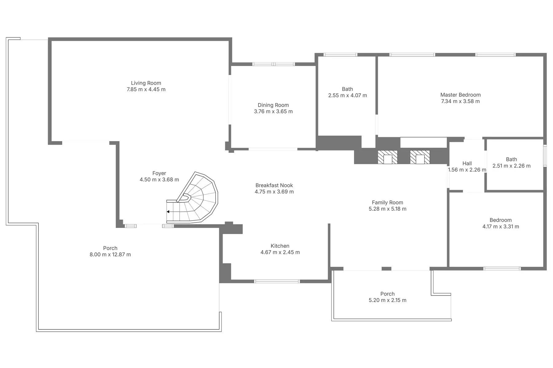
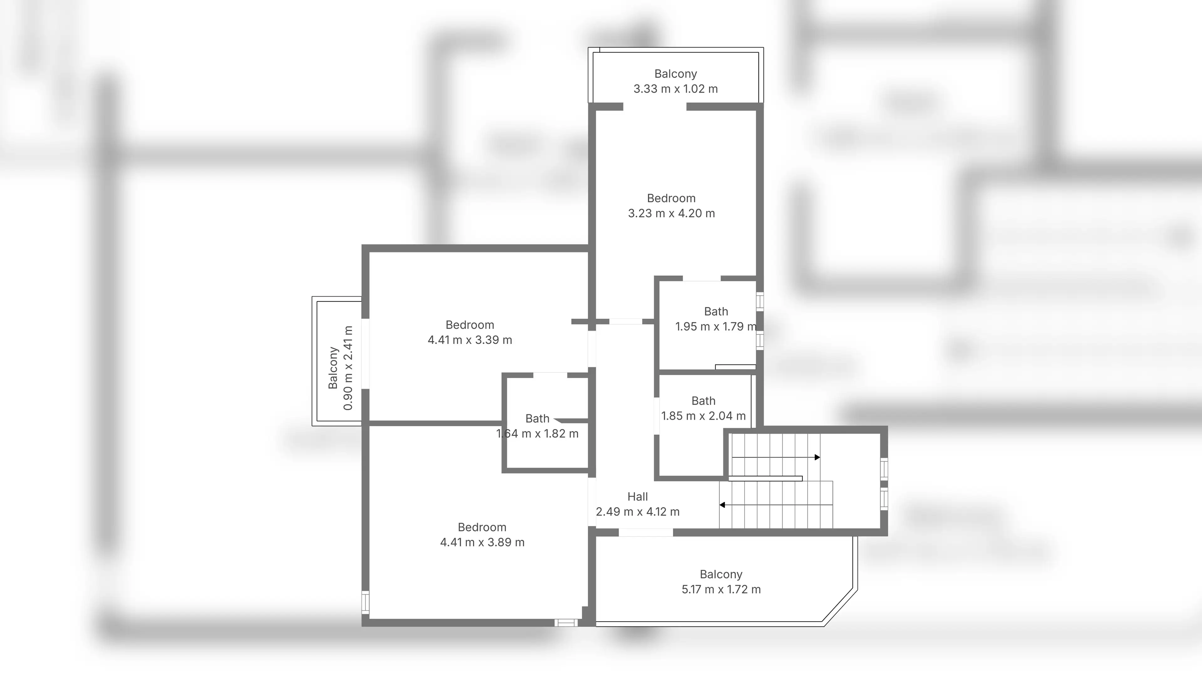
A floor plan is a drawing of a property seen from above, as if the roof had been lifted off. Solid lines are walls, gaps in them are doors, thin lines mark windows and the rooms are named. A property with several floors has one plan per floor. The result lets anyone read at a glance how the spaces relate to each other and how a person would move through them.
The word schematic describes the level of detail. A schematic floor plan keeps what matters to understand the layout and leaves out the rest: it shows the main divisions of the space, the position of doors, windows and stairs and the name of each room, with approximate dimensions to give a sense of proportion. It is a clear, easy-to-read picture designed for people who are not used to technical drawings.
It is worth separating it from a technical plan. An architectural plan is prepared by an architecture professional, drawn to scale and built on technical conventions, because it is used to design, build and approve. A schematic plan has a different job.
| Schematic floor plan | Architectural plan | |
|---|---|---|
| Purpose | To communicate the general layout | To design, build and document |
| Prepared by | A property marketing professional | An architecture professional |
| Measurements | Approximate, not exact | Exact and to scale |
| Nomenclature | Descriptive names for the spaces | Standardised conventions |
| Valid for | Listings and communication | Works, permits and official procedures |
What it shows, and what it does not
A schematic plan is very good at answering the questions a viewer has before a visit. How many bedrooms and bathrooms are there? Does the kitchen open onto the living room? Where is the staircase and what is on each floor? How is the terrace reached? Is there a separate area, such as a storage room or a garage?

How to read one
Start with the outline. Thick lines are the walls that enclose each room, and breaks in them are doors and openings. Thin lines on the outer walls are windows. Stairs appear as a series of steps, with an arrow showing the direction of ascent. The name of each space and its approximate dimensions sit inside it. With those four elements, anyone can follow the layout without any technical training.
It is just as important to be clear about what it does not do. A schematic plan does not follow exact measurements, so the dimensions it shows are indicative. It does not use standardised nomenclature. It is not a substitute for the official documents of the property, and it must not be used for any case that needs a technical document: building works, refurbishment, submissions to the town hall, legal matters or disputes.
Saying this openly protects everyone. The buyer understands what they are looking at, the agency avoids promising more than the plan can give, and the plan does the job it was made for.
How a schematic floor plan is obtained
When original plans exist and still match the property, they can be simplified into a schematic version. That is not always possible. Older properties may have no plans, and many have been modified since they were drawn. There are three common routes.
From existing plans
If the architect's drawings or the developer's plans are available, the layout can be redrawn in a simpler, easier-to-read form. It is quick, but it depends on the plans being up to date. If the owner changed a wall or added an extension, the drawing no longer shows the property as it is.
By measuring and drawing by hand
The traditional method is to walk through the property with a tape or a laser measure, sketch each room and draw the plan afterwards. It can be accurate, but it takes time, and small errors add up from one room to the next.
By scanning the property
The third route is to capture the property with digital devices that record its geometry. Software then turns the capture into a plan. It is faster than measuring by hand and works without original plans, because it records the property as it is today.
This is the route we follow. We scan the whole property in 3D, using different types of digital devices, and from that capture we produce a 2D schematic floor plan, one per floor, with each space named. The 3D scan is only a way of capturing the property. What you receive is a flat, easy-to-read plan, delivered as an image file through a download link.
The scan can be done during the same visit as photographs, video or a 360° virtual tour, which saves time for the owner and keeps all the material consistent. For a good result the property should be accessible and tidy: doors open, rooms free of obstacles and no other activity taking place. Our property preparation guide explains what to do beforehand.
Why a listing benefits from one
Photographs and a floor plan tell different stories. The photographs describe the condition and the atmosphere of the spaces. The plan describes the structure: how many rooms there are, how they are arranged and how large they feel in relation to each other. Together they let a viewer form a complete picture without visiting.
For agencies, that picture helps buyers decide earlier whether a property fits their needs, which can reduce visits that were never going to lead anywhere and make the ones that happen more productive. It also helps a listing to be remembered, because a layout is easier to recall than a list of rooms. We see this clearly with real estate agencies that present every property with the same set of photographs and plan.
A plan is also easy to share. A buyer who lives abroad can send it to a partner or a relative and discuss the layout before anyone books a flight, in the same way as with a virtual tour. That kind of conversation tends to happen before a visit, and the plan gives it a common reference.
For holiday rentals the benefit is practical. Guests can see how many bedrooms there are, where they are in relation to the living areas and how the outdoor spaces connect, before they book. That is part of setting honest expectations, and it is a regular request from vacation rental agencies.
How to use it well in a listing
A plan works best when it is easy to find and easy to read. Place it after the main photographs, where a viewer who is already interested looks for more information. Use it on every property in your portfolio, not only on the larger ones, so that your listings are consistent and comparable.
Be transparent about its nature. A short note in the description, saying that the plan is schematic and its dimensions are indicative, avoids misunderstandings and is good advertising practice. When the listing needs exact surface figures, use the official documents of the property and not the plan.
Keep the file ready in the formats your portals accept, and store a copy with the rest of the property's marketing material so that any member of the team can find and use it. A plan that is hard to locate tends to be left out of the listing.
Combine it with the other pieces. The photographs attract attention, the plan explains the layout and a virtual tour lets interested viewers walk through it. Each piece answers a different question, and none of them replaces the others.
Questions to ask when you order one
- How is the plan made? From existing plans, by hand or from a scan of the property.
- What exactly is delivered? The format, one plan per floor and how the spaces are labelled.
- Are dimensions shown, and how should they be read? They should be described as approximate.
- What is the plan not valid for? A responsible provider will tell you plainly that it is not for works, permits or legal procedures.
- When will it be delivered? Ask for an estimated date in writing.
- What does the licence of use cover? Portals, your website and social media are the usual channels; ask about anything beyond them.
- Can it be captured in the same visit as the photographs or the tour? It saves time and keeps the material consistent.
If the answers are clear, you are probably dealing with someone who knows what a schematic plan is for. Our page on schematic floor plans shows examples of the result.
If you want the wider picture, our complete photography guide explains how architectural and real estate photography relate and what makes any image work.
Frequently asked questions
-
What is a schematic floor plan?
It is a simplified top-down drawing of a property, one per floor, that shows the rooms, how they connect and where doors, windows and stairs are. It is meant to communicate the general layout in a glance.
-
How is it different from an architectural plan?
An architectural plan is a technical document prepared by an architecture professional, drawn to scale and following technical conventions. A schematic plan is a communication tool: it does not follow exact measurements or standardised nomenclature.
-
Can I use it for permits, building works or legal procedures?
No. A schematic floor plan is not valid for building works, refurbishment, submissions to the town hall, legal matters or disputes, or any case that requires a technical, standardised document prepared by an architecture professional.
-
How is a schematic floor plan made?
There are three common routes: simplifying existing plans, measuring and drawing by hand, or scanning the property. In our case we scan the whole property in 3D with different types of digital devices and produce a 2D schematic plan from that capture.
-
Do I need the original plans of the property?
Not with a scan. The property is captured as it is today, which is useful when the original plans are missing or no longer match the property after changes.
-
Are the dimensions on the plan exact?
No. A schematic floor plan may show the approximate dimensions of each space to help the viewer understand proportions, but it does not follow exact measurements and should not be used to state official surface areas.
-
Can I add a floor plan to property portals?
Most portals allow you to add a floor plan image to a listing. Requirements vary, so check the format and size each portal accepts before you publish.


